Warning: file_get_contents(https://nishiharakanko.com/wp-content/themes/nishiharamura/js/google_gtm_head.txt): failed to open stream: HTTP request failed! HTTP/1.1 429 Too Many Requests in /home/xs799320/nishiharakanko.com/public_html/wp-content/themes/nishiharamura/header.php on line 14

Warning: file_get_contents(https://nishiharakanko.com/wp-content/themes/nishiharamura/js/google_gtm_body.txt): failed to open stream: HTTP request failed! HTTP/1.1 429 Too Many Requests in /home/xs799320/nishiharakanko.com/public_html/wp-content/themes/nishiharamura/header.php on line 15
【俵山】登山マップ完成! - 西原村観光協会

JP

新着情報 新着情報
Menu

お知らせ

新しいサービスや商品、イベントなどの情報をお知らせ致します。
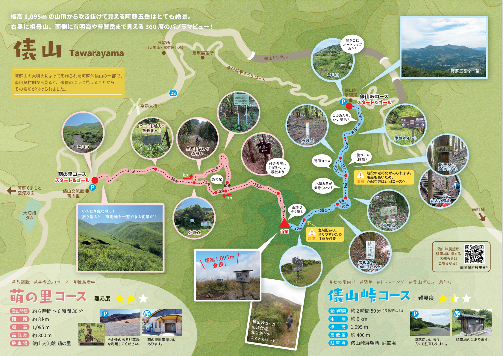
【俵山】登山マップ完成!

2024.3.25

俵山登山マップが完成しました

この度、俵山登山マップが完成しました。


南阿蘇方面に向かう道中、目の前に現れる大きな山

俵山交流館萌の里より眺める山の麓

・・・阿蘇の外輪である”俵山”について、今まで多くのお問い合わせをいただいておりました。


駐車場ってどこに停めればいいの?

萌の里から見えているあの場所まではどれくらいかかるの?

コースはいくつあるの?

などなど


そんなお問い合わせ内容に応えるべく、駐車場や登山道についてや、登山を始めるうえで基本的なあれこれをA4サイズ一枚にまとめた登山マップです。

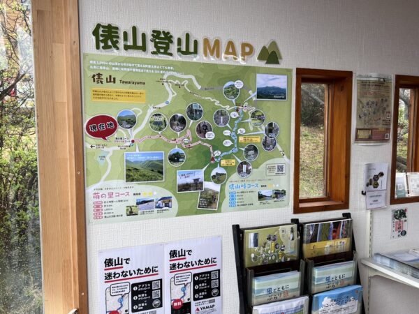
萌の里観光案内所にて本日より設置しております。
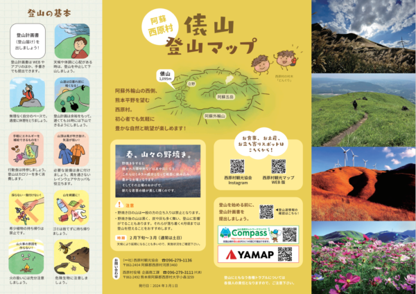
是非お手に取ってご覧ください。


登山マップ-オモテ

登山マップ-ウラ

タグ

トップに戻る